Monday, July 26, 2010

Broken Shoulder Adventure

Thirteen days ago, I fell at home and sustained a "minimal" fracture in my right shoulder. Believe me, it did not FEEL minimal. Anyways, that put my geocaching, exploring and flickering to a complete stop. I was getting a severe case of "cabin fever" so I asked (begged) my friend Leslie to take me out to do something fun this week and she was kind enough to oblige me. I am so blessed to have a friend like her.

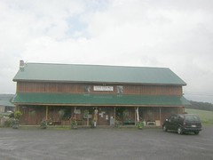
I drove into Rite Aid near her house and she met me there. We headed out Route 7 to Worcester. We located two fairly new geocaches in Worcester. One is in a brand new park near the historical society. The society was closed today, but I took a picture of the contact numbers for future reference. What I could see through the windows makes it look like an interesting place. The other is along the road by Gulf Falls, pictured here.


After that we had lunch at Ardy's. Leslie wanted to take a back road to Westford instead of going on the main roads. We had a few difficulties doing this because of the lack of County Road signs, but we did make it to Westford via several back roads.

We stopped first so that Leslie could find my WESTFORD CACHE. There is a new sign for the park it is hidden in, so I took a picture of that. Leslie found the cache quickly and put a geocoin in it. She said the cache is in good shape.

Next stop was at the BADEAU CEMETERY. This small civil war cemetery is on a small steep hill.
I decided not to chance it with my injury, but Leslie scrambled up and found it after a few minutes. I will return another time when my shoulder is back to
normal.

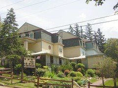
On the way back to Route 7, we looked for and found THE GODDARD HOUSE, a historical house outside of Schenevus on Elk Creek Road. See the dog on the lower left hand side? This dog came out as soon as we pulled the car to a stop and barked up a storm. Leslie took the picture out of her window.

All in all, it turned out to be a great day. The wonderful weather helped!

Saturday, July 10, 2010

Brookwood Gardens and More Adventure

Carol M and I set out this morning for a day of exploring. I gave her the map and we headed towards
Richfield Springs, New York.

We stopped briefly in the hamlet of Schuyler Lake, New York when we noticed the small historical society. It was not open but the phone number for a contact person was on the door.

Next stop: DYN'S CIDER MILL on Route 20 west of Richfield Springs. The owner was very friendly and offered us several samples. We spent about twenty minutes before moving on. We watched for the BAKER OCTAGON BARN, on her suggestion. It was just down the road.

We arrived in Richfield Springs and stopped at SPRING PARK. Carol had never seen it up close. I tried a taste of the sulphur water from the spring and we walked around a bit and I took a few pictures.

By this time it was lunch time and I suggested that we take a short drive to Jordanville to CINDY'S KITCHEN AND PANTRY, a place I had read about on the www. Unfortunately, Cindy and her staff seem to be on vacation, so the place was closed. It looks like the small building may have once been a small town general store, and indeed it still does sell some merchandise as well as provide meals. I hope to return someday. We headed back to Richfield Springs but stopped to take a few pictures of a very interesting small church. It is the CHURCH OF THE GOOD SHEPHERD (Episcopal) in Cullen, New York. Here is a picture of it.

Once we got back to Richfield Springs, we "cruised" Main Street before deciding to
eat lunch at a small diner. Carol and I split a cheesesteak sandwich and fries. They were VERY slow in preparing our order, but when it came, it was fine.

Our next stop was the RICHFIELD SPRINGS HISTORICAL ASSOCIATION MUSEUM. They do not have a whole lot of artifacts at this small museum, but they do have a lot of historical information. We learned a bit about the "hotel days". Richfield Springs served a wealthy clientele in the summer time in those good old days.

We went into a small antique store for a few minuts and looked around for a place that had postcards, but we were not successful.

Then it was time to head to Cooperstown so that we could be at Brookwood Gardens by three p.m. The woman I spoke to on the phone the previous day said that if we were at the gardens at three p.m., we would be able to go into the Garden House, since she had an appointment to open it up to show to a prospective bride.

We had a bit of extra time, so along the way we stopped for two geocaches. The first one we were unable to search for because of a HORSE! An Amish guy seems to have driven his horse and buggy pulling a trailer with a boat to the fishing access spot. His horse was parked right where my GPS was pointing, so I skipped looking for that particular geocache. I was successful at the next one, which was ROCK OF AGES, and hidden behind a sign at the intersection of 20 and 80, just outside of a cemetery.

We arrived at Brookwood Gardens a couple of minutes after three p.m. and went inside the Garden House and walked around the gardens, and I took a lot of pictures, which can be seen here: http://www.flickr.com/photos/juneny/sets/72157624467063898/ It was a great day, and I think Carol M. enjoyed it as much as I did!

Thursday, July 1, 2010

Return to Bainbridge Adventure

Linda and I decided to go to Bainbridge today, mostly to go to the FROG POND, the huge fruit and vegetable stand there. We met up at my house and headed out. First stop: FROG POND. It was their last day open before closing down for a two week summer vacation, so I thought that they would not have much to offer, but I was wrong. They had a lot! Both Linda and I purchased a LOT of fresh fruits and vegetables.

Second stop: Pine Ridge Grocery (otherwise known as the Mennonite Store). Once again, both of us made several purchases.

Then it was time for lunch. We wanted something inexpensive and light. We took a chance and went into the Olive Branch at the Jericho, which was formerly (and not too long ago) known as The Old Jericho Inn. It is a beautiful old building which used to be known as the Central Inn in the 1850's.

We had chicken wing pizza. The total bill was $6.00, and that included drinks.......so we met our goal of having an inexpensive meal. The pizza was good, too.

I had never taken any pictures of the building that used to be the train depot, so I took this opportunity to do so. The building is now used for village offices, but it still has the train depot look to it.

I had geocaching info. with me, but Linda is recovering from total hip replacement, and I didn't think she was up to doing it. We had perishable food in my car, so we decided to head for home so we could get it refrigerated. On the way home, we made one small detour, so I could show Linda the Otego Creek fishing access area on Route 8.


Friday, June 25, 2010

A DUCKY Adventure: June 25, 2010


Mama Duck and two babies
Originally uploaded by JuneNY
Luckless and I met up at 11:30 or so in Oneonta in order to go geocaching for a few hours. I told her which caches were available that we have not found yet. She really wanted to find THE HATCHERY, so we headed to Riddell Park, just outside of Oneonta in the Colliersville area.

The cache site was about a half a mile from the parking area. It was a gorgeous day, hot but not too terribly humid. Once we got to the area where the geocache was hidden, Luckless found it quickly.

It was a HUGE round canister. We took it to a nearby picnic area so we could sit at a picnic table. We had a bit of trouble opening it, but we finally realized that the container did not PRY open, that the top turned to the left and came off.

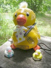
Inside was a large MAMA DUCK, and a bunch of small baby ducks. TEAM DUCKY provided markers so that each finder can decorate their own ducky. The MAMA DUCK (seen in the picture up above) is the "log" for the cache and each finder signs on it. Luckless and I signed the log and then we each proceded to make our own baby duck. Luckless had a theme all picked out before we got there. Her theme was "hatchling". I did not have a theme or any ideas, so I just decorated my little duck and named it "ducky duck". Am I not at all creative or what? I do not have a creative bone in my body.

We were able to sit at a picnic table in a very nice picnic area on the edge of Schenevus Creek while we decorated our ducks. (middle picture up above shows my decorated duck). It was so much fun to make my own ducky, and so nice to spend time along the creek. When finished, we packed up the geocache and took it back to the site, and Luckless rehid it. I thoroughly enjoyed walking this trail at Riddell, except for the part when we ran into a couple of people with a dog that was NOT on a leash. (people who do not follow basic rules irritate me and I do not like dogs a whole lot). We went back to van and discussed what geocache to search for next.

We decided on DUCKY DEAD END FOUR, but we took a short break and stopped at PONDO'S for ice cream. I had a large marshmallow sundae with soft chocolate ice cream. It was really good. Then we headed over to the Charlotte Creek Fishing Access area. We located part one, but the clue did not work for us. There was a pen inside the cache which has a tiny light on it. We tried everything we could think of to light up a spot that would give us the coordinates for the second part of the cache, with no luck. Luckless had located the second part (without the coordinates) a few days before that, so we headed towards the spot where she found it.

It was like a walk through the jungle! (see picture way up at the top) That area is so overgrown. I doubt if many fishermen really take the time and effort to walk back to the fishing area. But we followed what tracks we could see (very faint in places) and eventually arrived at the cache site. There are a lot of wild rose bushes with prickers, and also some kind of shrubbery or small trees that have HUGE leaves. I had a heck of a time finding it and Luckless had to play the "hot and cold" game to help me zero in on it. Eventually, I found it, and signed the log and rehid it. Now it was time for another walk through the JUNGLE of ONEONTA. This time I moved faster, since I knew what to expect and I was anxious to get away from the bugs, mud puddles and overgrowth.

I dropped Leslie off, picked up some milk and headed for home. It was a fun afternoon!


Friday, June 18, 2010

RETURN TO STAMFORD ADVENTURE!


Today I took my friend Linda to the nursing home in Stamford, New York so she could visit her mother.

While she was there, I did some exploration in the Village of Stamford. I located the BELVEDERE COUNTRY INN. It is the last remaining OPEN hotel in Stamford. The dozen or so others all closed down in the twentieth century.

Basically, I walked in the front door and explored most of the first floor for several minutes. Then I rang a bell at the "check in" desk and inquired about room rates, etc. I was shown a couple of rooms on the second floor.
The rooms are nice, but they do not have any air conditioning. One of the "double" rooms has a very nice sitting area. I took a lot of pictures which can be seen on my flickr photostream.

I was able to locate THE COLONIAL, a mansion right next door to the Cyr Center. It is indeed beautiful, but I did not stop to take any pictures.

I tried to find 5 Lake Street so I could see THE REXMERE LODGE, but no luck, I just could not find it. I found 7 Lake Street and right next door to it is Stewarts.

While driving down Main Street, I noticed a huge bell covered by a gazebo. I stopped to see if there was a plaque, but there was not one. It is in the yard of the United Methodist Church. Across the street is a colorful and interesting ice cream shop, which I took a couple of pictures of.

By then it was time to go pick Linda up at the nursing home. She chose TP's Cafe for lunch. I had the Beef Taco Salad and it was very good. I took a picture of the beautiful old tin ceiling. After lunch, we headed back to Linda's place where I dropped her off. We passed a geocache on the way, but I skipped it because it was getting so late.


Thursday, June 17, 2010

Table Rock ADVENTURE


Table Rock
Originally uploaded by JuneNY
There is a geocache hidden at TABLE ROCK. I have wanted to look for it since it was hidden about a year and a half ago, but today was my first good opportunity.

Luckless had told me a few times that you can drive right up to this cache, but she must know a different way to get to it.

emoneonta and I drove up to the Hartwick campus after working this morning. We had a bit of a hard time figuring out the best parking area, mostly because it was so overcast that our GPS's took a long time to get satellites. Eventually, we asked a security guy what was the best way to get there and he pointed us to the trailhead.

It was a bit of a walk uphill and then in the woods to get to the area known as TABLE ROCK. It is so neat! I had no idea that it was so huge! My GPS never really settled down, so we relied on Eileen's and it took us to within a couple of feet of the geocache. The name of it is TO THE BATCAVE, and the clue was "QUITE THE CLIFFHANGER".

Eileen spotted it, I retrieved it and emptied it out. We each took something and left something and signed the log and then walked back down to the parking area.

It was a great time in spite of it being cool, gray and overcast.

Monday, June 14, 2010

Geocaching ADVENTURE with Leslie to celebrate her birthday!


Luckless Under the Bridge
Originally uploaded by JuneNY
I knew Leslie's birthday was coming up, so I emailed her last week and asked her if she would like to do some geocaching together in order to celebrate her brithday. We agreed on Monday, July 14th (today) even though her birthday was actually the 13th. I was busy with the golf tournament on the 13th.

We met up at her house at 9:30. We went first to find GET SWART: a very easy geocache to find, located at the Swart House off of River Street in Oneonta. I really need to take pictures of this house, but today it was sprinkling, so I will wait until a nicer day.

After that, over to WalMart where we quickly found the new and improved edition of ALWAYS ONEONA.

Then we began to look for Ducky Dead End Four. We were unsuccessful, but basically I think we just need to approach this one from the opposite side of the river.

We went on out to Davenport Center and quickly found DAVENPOT CENTER CACHE, one that Peggy an I had unsuccessfully looked for over Memorial Day weekend. This time I found it rather quickly, it was not in the area that Peggy and I searched in before. Oh well.........

Then we went to Colliersville to try again for BRIDGE OVER DUCKY WATERS. Once again success eluded us. I think we need an extra hint from the owners. I suggested to Leslie that we might need to go to a website that has pictures of alternative cache containers............and maybe we will see a picture of what we should be looking for.

It was just about noon, but I suggested we might look for one more geocache: DUCKY DEAD END 3. It was hidden in among some huge rugged rocks under a bridge down by a fishing access area.
Leslie was brave enough to go where I would NOT go........and she found it. There were some interesting handmake metal sculptures right near the geocache site. A picture is up above.

By then we were hungry and decided to try the new POLAR SCOOPS on Main Street, Oneonta. They just opened a few days ago. Both Leslie and I were disappointed. They overcharged Leslie for her milkshake. Leslie was finished with her pizza and shake long before my pepperoni roll was prepared. I brought it home and it was not very good. I am not sure I encountered even one piece of pepperoni.

It was a great morning of geocaching! We found four out of six that we looked for.